 Sử dụng hàm trọng lượng - tuyến nhằm tăng cường độ phân giải trong phân tích tài liệu từ và trọng lực bằng phép biến đổi Wavelet
The multiscale edge detection (MED) using wavelet transform was used to solve the inversion problem of gravity and geomagnetism to determine the positions and the depths of sources. In this paper, we used the line-weight function (LWF) to treat the observational data to enhance the resolution of the results of MED method. Firstly, the method...
 7 trang | Chia sẻ: honghp95 | Ngày: 28/11/2020 | Lượt xem: 721 | Lượt tải: 0
 Trữ lượng nước dưới đất vùng Hà nội và định hướng điều tra đánh giá, khai thác sử dụng
The expanded Hanoi area is large, but the investigation levels are different. Only in the old area (921 km2 area), assessment of groundwater (GW) reserves has been done, with high water potential. The potential GW reserves is about 6 million m3 per day which are mainly in quaternary sediments, specially in Pleistocene aquifer (qp) for water ...
 7 trang | Chia sẻ: honghp95 | Ngày: 28/11/2020 | Lượt xem: 832 | Lượt tải: 0
 Nguồn hình thành trữ lượng nước dưới đất vùng lưu vực sông Sài Gòn
Originating source of groundwater reserve is not only one of research speciality in hydrogeology, but also an important information for groundwater resources exploitation management and protection. Commonly, its calculation is complicated, especially in areas of complex hydrogeological conditions such as Saigon river basin. Therefore, this pr...
 9 trang | Chia sẻ: honghp95 | Ngày: 28/11/2020 | Lượt xem: 862 | Lượt tải: 0
 Đặc điểm thành phần, chất lượng sét gốm khu vực Nho Quan tỉnh Ninh Bình
Pottery clays of the Ninh Binh province are mainly distributed in the Nho Quan. Two types of pottery clay origins have been discovered, weathering clay in Song Boi Formation (T2-3 sb) and sedimentary clay associated with the Vinh Phuc Formation (Q13vp). Weathering pottery clays are less promising, since their limited distribution on the slop...
 9 trang | Chia sẻ: honghp95 | Ngày: 28/11/2020 | Lượt xem: 698 | Lượt tải: 0
 Vị thế và dự báo xu thế phát triển vùng của sông châu thổ sông Cửu Long
The Mekong delta where Hau river and Tien river, two branches of Mekong river flow in Vietnam by 9 estuaries which include 3 estuaries of Hau river (Tran De, Dinh An, Bat Xac) and 6 estuaries of Tien river (Co Chien, Cung Hau, Ham Luong, Ba Lai, Tien, Dai). Nowadays, Bat Xac estuary has been extended by running process of Hau River from the ...
 6 trang | Chia sẻ: honghp95 | Ngày: 28/11/2020 | Lượt xem: 900 | Lượt tải: 0
 Đặc điểm tân kiến tạo - Địa động lực hiện đại thành phố Lào Cai
The Lao Cai city has been strongly influenced by Neotectonic and present-day geodynamic activities that created and modified some prominent structures such as : the Posen uplift with uplifting rate ranging from 0.14 to 0.28 mm/yr ; the Con Voi Range with post-metamorphic exhumation rate ~10 mm/yr at early stage and decreased by 0.15 mm/yr in ...
 8 trang | Chia sẻ: honghp95 | Ngày: 28/11/2020 | Lượt xem: 1071 | Lượt tải: 0
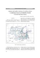 Đánh giá hiện trạng và phân vùng cảnh báo nguy cơ trượt lở đất thành phố Đà Nẵng
The landslide occurence in the Da Nang city is strongly affected to the social-economic developent. - At least 110 landslide sites were detected during the last few years, among them 20 blocks are very large in size. The investigations are indicated that, the higher density of landslide is concentrated in the areas of Hoa Lien - Hoa Bac, Doc ...
 8 trang | Chia sẻ: honghp95 | Ngày: 28/11/2020 | Lượt xem: 747 | Lượt tải: 0
 Một số phương pháp nghiên cứu ngưỡng mưa nhằm cảnh báo trượt lở đất
To follow the experience of U.S. and European scientists using the rainfall thresholds for landslide warning, in this paper the author attempts to establish the preliminary rainfall thresholds causing landslides in Ha Giang province, on the basis of field works (2006-2008), the reports about natural hazards of locality, and the rainfall data o...
 9 trang | Chia sẻ: honghp95 | Ngày: 28/11/2020 | Lượt xem: 859 | Lượt tải: 0
 Vai trò của rừng ngập mặn trong quản lí đới bờ
Mangrove forests are classified as the most vulnerable ecosystem among the coastal ecosystems. Mangrove forests are also dynamic systems and have direct influences on coastal erosion and accumulation processes. Mangrove forests are considered as an effective and friendly barrier for the coastal habitants against high waves, storms and especi...
 5 trang | Chia sẻ: honghp95 | Ngày: 28/11/2020 | Lượt xem: 908 | Lượt tải: 0
 Thoái hoá đất và quá trình hoang mạc hoá ở vùng nam Trung Bộ
The soil degaradation and desertification are affects resulting from the loss of the ecological balance by the natural processes and socio-economical activities in the arid, semi-arid and dry sub-humid areas. According the geo-synthetization, the soil degradation is a main cause leading to the desertification. In Central Southern of Vietnam, ...
 8 trang | Chia sẻ: honghp95 | Ngày: 28/11/2020 | Lượt xem: 866 | Lượt tải: 0
Copyright © 2026 Tai-Lieu.com - Hướng dẫn học sinh giải bài tập trong SGK, Thư viện sáng kiến kinh nghiệm hay, Thư viện đề thi


